Idaho Hunt Planner We got game.
Hunt Area
That portion of Unit 63 north of US Highway 20, excluding the Camas National Wildlife Refuge which is closed and including those portions of Units 59 and 59A that are within 1 mile north of State Highway 22.
More information about the Game Management Unit(s) in this area: 59 59A 63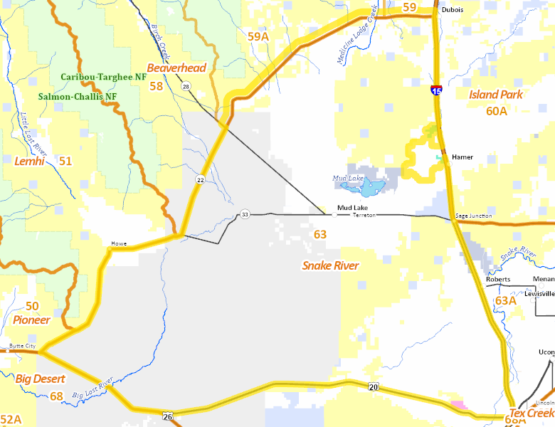
Recent Hunts in this Area
| Year | Tag | Open | Close | Take Method | Game | Area |
|---|---|---|---|---|---|---|
| 2024 | Elk Controlled Hunt 2284 | 1/1/2025 | 2/15/25 | Muzzleloader | Elk | Area 63-1X |
Surface Management
For government land, these data show the managing agency of the land, which may or not be the same as the owning agency.
 U.S. Department of Energy (DOE) 44.4%
|
|
Private 34.94%
|
|
U.S. Bureau of Land Management (BLM) 17.79%
|
|
State of Idaho 2.51%
|
|
U.S. Military 0.11%
|
|
U.S. National Wildlife Refuge (NWR) 0%
|
Make your own map of Hunt Area
Ownership data source: Inside Idaho
Access Yes! Properties
Access Yes! is Fish and Game program designed to improve hunting and fishing access to private land or through private land to public land by compensating willing landowners who provide access.
No properties are currently available in .
View all Access Yes Participants.
Forest Service Land
Check for road and area closures on National Forest websites
No National Forest lands fall within .
Federally-designated Wilderness Areas
No motorized vehicles are allowed in these areas.
There are no wilderness areas in .
Land Use/Land Cover
No landcover for this area is available at this time.
Towns in this Hunt Area
No services are available inside .
Services courtesy of the Official Idaho Travel and Tourism Guide