Idaho Hunt Planner We got game.
Hunt Area
That portion of Unit 68A within the following boundary: beginning at Ferry Butte Road and State Highway 39, then northeast on State Highway 39 to U.S. 26 near Blackfoot, then east on U.S. 26 to Interstate 15, then north on Interstate 15 to Idaho Falls, then east on Broadway Street to U.S. 91 to Ferry Butte Road, then west on Ferry Butte Road to the point of beginning.
More information about the Game Management Unit(s) in this area: 68A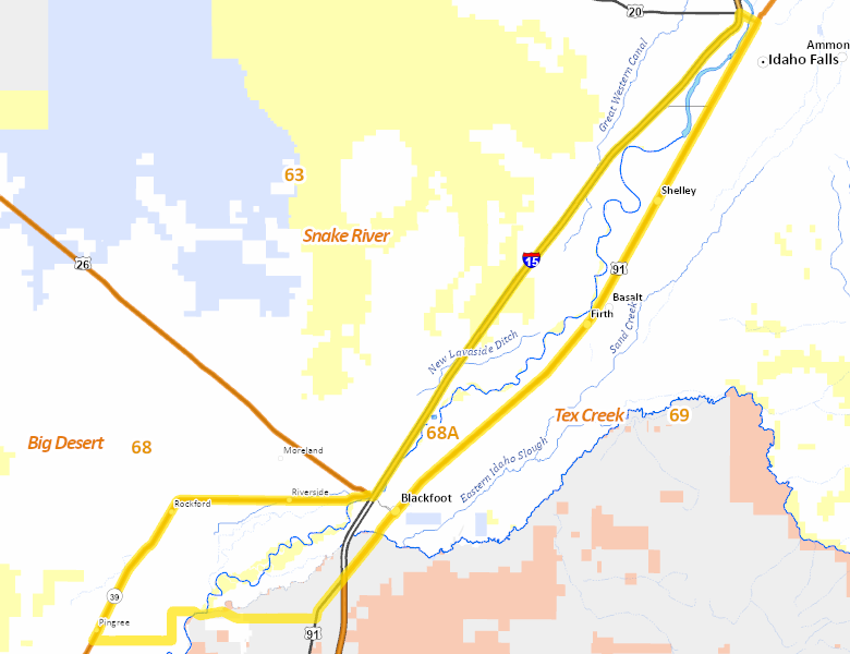
Surface Management
For government land, these data show the managing agency of the land, which may or not be the same as the owning agency.
No landownership for this area is available at this time.
Access Yes! Properties
Access Yes! is Fish and Game program designed to improve hunting and fishing access to private land or through private land to public land by compensating willing landowners who provide access.
No properties are currently available in .
View all Access Yes Participants.
Forest Service Land
Check for road and area closures on National Forest websites
No National Forest lands fall within .
Federally-designated Wilderness Areas
No motorized vehicles are allowed in these areas.
There are no wilderness areas in .
Land Use/Land Cover
No landcover for this area is available at this time.
Towns in this Hunt Area
No services are available inside .
Services courtesy of the Official Idaho Travel and Tourism Guide